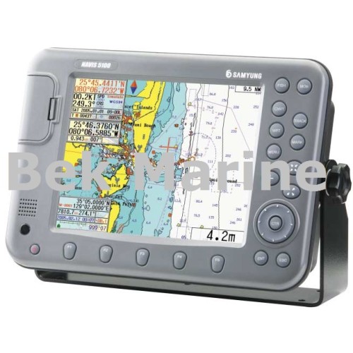
Samyung enc Navis 5100 GPS ChartPlotter
GPS Chartplotter System: Samyung enc Navis 5100 GPS ChartPlotter
SAMYUNG enc NAVIS 5100 GPS Chart Plotter
Features
- Adoption of 10.4”TFT LCD color display enables better resolution.
- WGS84 geodetic system automatically enables all the geodesic lines to automatically convert.
- Smooth conversion to other displays prevents the map from disappearing while ZOOM IN/OUT.
- C-MAP NT MAX available.
- Combination with SAMYUNG autopilot system offers perfect autopiloting.
- Latest electronic chart with wide range of updated technology offering a variety of information such as slime, rock, depth, trench,
- EEZ line, underwater cable line and the like.
- Straight pursuit and ZOOM IN/OUT enabling users to make exact calculation of fish group at the sea bottom (NAVIS 5100F)
- Use of 2(two) frequencies in common offering better judgment on minute fish groups.(NAVIS 5100F)
Specifications
GPS Receiver
- Receiving frequency : L1 1575.42MHz(C/A CODE)
- Receiving channel & tracking satellite : 16 channels & 16 satellites
- Receiving type : Digital 16 channel multi tracking type
- Receiving sensitivity : -143dBm
- Accuracy Velocity : 10M 2D RMS(PDOP<2) (SA OFF) / 0.1kt RMS (HDOP<2) (SA OFF)
PLOTTER
- Display : 10.4”COLOR VGA TFT LCD
- Resolution : 640x480 PIXELS
- Projection : Mercator drawing
- Effective range : below 85。of latitude
- Way point : 20,000 points
- Effective range : 0.25 mile ~ 5,000 mile(1/2000~1/37,500,000)
- Tracking memory interval : 1 sec~60 minute(0.01~9,99NM) setup
- Tracking capacity : 20,000 points
- Mark : Event mark : 21 kinds / Mark capacity : 10,000 points /capacity for user’s drawing of shoreline : 8,000points 16 land coloring
- capacity for user’s marking of shoreline : 1,000points / capacity for user’s character of shoreline : 1,000points
- capacity for tracking marking : 1,000points / capacity for memory of destination : 1,000points
- capacity for memory of route : 20 routes (20 points/1 route)
- Display mode : normal, true-motion, course-up, north-up, head-up function
- Alarm : 1)arriving alarm 2)off-course alarm 3)anchor alarm 4)boundary alarm
- Temperature : Antenna : -40℃ ~ +50℃, Main unit : -10℃ ~ +50℃
- Interface : SAMYUNG, NMEA 0183, FURUNO(CIF), JRC
- Power Supply: DC +12~36 VDC
Components
- STANDARD
- GPS LCD plotter 1SET
- GPS antenna 1EA
- Transducer for (NAVIS 5100F) 1EA
- Installation materials, spare parts, manual 1 LOT
- OPTION
- SD card
- C-MAP NT+, MAX
- Power supply

